


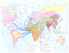


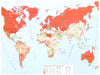


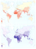


Published by Éditions Jeune Afrique in 1973, The Atlas of Africa sets out the postcolonial continent's states and economies country by country and theme by theme. National sheets show the political geography of the day, while thematic maps cover agriculture, livestock, minerals, industry and transport, with roads, railways, pipelines and ports carrying produce to domestic and overseas markets. Population, religion and migration add the human geography. Coverage runs from North Africa to the south and out to Mauritius, Réunion, the Comoros and the Canaries, and names such as Rio de Oro and Swaziland preserve the atlas's own period terminology.
EU orders up to €150 are sent VAT- and duty-paid — no additional taxes on arrival
Authenticity Guaranteed - We only sell original antique & vintage items
Can we help? Call us on +44-208-960-3476 • FAQs
All our products are exempt from US tariffs — no additional duties or taxes payable on arrival.


- Shop by Country
- Shop by Cartographer
- Shop Maps by Type
- Shop Prints by Subject