


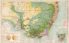


Crops, minerals, factories and shipping lanes map world trade as the interwar years saw it in The Chambers of Commerce Atlas of 1925. George Philip and T. Swinborne Sheldrake edited it for the Times Trade and Engineering Supplement, under the auspices of the Association of British Chambers of Commerce. Thematic sheets cover fuels, metals, food production and water power, regional commercial maps link these resources with manufacturing districts and farmland in Britain, North America, Europe and Asia, and steamship routes across the Atlantic and Pacific and maps of diplomatic and consular representation chart the means of exchange.
EU orders up to €150 are sent VAT- and duty-paid — no additional taxes on arrival
Authenticity Guaranteed - We only sell original antique & vintage items
Can we help? Call us on +44-208-960-3476 • FAQs
All our products are exempt from US tariffs — no additional duties or taxes payable on arrival.


- Shop by Country
- Shop by Cartographer
- Shop Maps by Type
- Shop Prints by Subject