


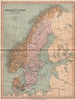


Victorian schoolroom history and contemporary political geography meet in The Collegiate Atlas, published by William Collins, Sons and Company in the 1870s. Alongside regional sheets of the German Empire, British India, the Australian colonies and the United States, including territories that had not yet become states, the atlas reconstructs Europe from Roman times through the medieval and Napoleonic periods. Roman roads in Britain, Saxon territories and the English possessions in France put historical events on the map, world maps trace European discoveries and colonial expansion, and Palestine is divided among the biblical tribes.
EU orders up to €150 are sent VAT- and duty-paid — no additional taxes on arrival
Authenticity Guaranteed - We only sell original antique & vintage items
Can we help? Call us on +44-208-960-3476 • FAQs
All our products are exempt from US tariffs — no additional duties or taxes payable on arrival.


- Shop by Country
- Shop by Cartographer
- Shop Maps by Type
- Shop Prints by Subject