


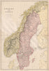


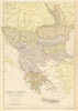


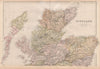

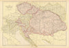


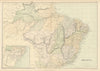


Victorian railways, colonial territories and long-vanished place names fill these maps from The Comprehensive Atlas & Geography of the World, the Blackie & Son publication supervised by W. G. Blackie, in issues dating from the 1880s. Australian sheets show New South Wales, Victoria and part of Queensland with their railway routes, and North American maps distinguish the Atlantic states and the Mississippi valley. South American maps still record New Granada and Bolivia's coastal province, while Pacific sheets set the island groups against Australia, New Zealand and East Asia.
EU orders up to €150 are sent VAT- and duty-paid — no additional taxes on arrival
Authenticity Guaranteed - We only sell original antique & vintage items
Can we help? Call us on +44-208-960-3476 • FAQs
All our products are exempt from US tariffs — no additional duties or taxes payable on arrival.


- Shop by Country
- Shop by Cartographer
- Shop Maps by Type
- Shop Prints by Subject