


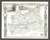

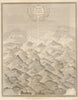


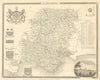


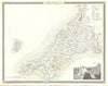


Gothic borders, heraldry and small landscape vignettes make maps from The English Counties Delineated as decorative as they are useful. Thomas Moule's work was published by George Virtue in London, here in the 1837 issue, and alongside the English counties it includes a divided Yorkshire, the Isle of Wight and the Isle of Man. Town plans show Oxford, Bath and Plymouth with Devonport, London sheets cover the environs and the parliamentary boroughs created by reform, an inland-navigation map follows the canal network, and a comparative diagram ranks the heights of British hills. The vignettes link each county's outline with its historical monuments.
EU orders up to €150 are sent VAT- and duty-paid — no additional taxes on arrival
Authenticity Guaranteed - We only sell original antique & vintage items
Can we help? Call us on +44-208-960-3476 • FAQs
All our products are exempt from US tariffs — no additional duties or taxes payable on arrival.


- Shop by Country
- Shop by Cartographer
- Shop Maps by Type
- Shop Prints by Subject