


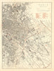

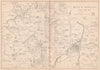


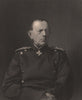

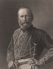






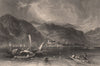

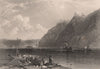


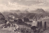


Battle plans and Rhine scenery make an unexpected pairing in prints from The Franco-Prussian War, the history edited by Captain H. M. Hozier and published in London by William Mackenzie between 1872 and 1875. Maps reconstruct the battles around Metz, Sedan, Belfort and the Loire, Paris sheets show the fortifications and the routes of troops in the later fighting in the capital, and portraits introduce the commanders and politicians involved. The views of towns, castles and river scenery in Germany, Switzerland and neighbouring districts come from W. H. Davenport Adams's account of the Rhine Valley, which the publication also included.
EU orders up to €150 are sent VAT- and duty-paid — no additional taxes on arrival
Authenticity Guaranteed - We only sell original antique & vintage items
Can we help? Call us on +44-208-960-3476 • FAQs
All our products are exempt from US tariffs — no additional duties or taxes payable on arrival.


- Shop by Country
- Shop by Cartographer
- Shop Maps by Type
- Shop Prints by Subject