


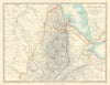


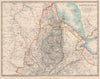


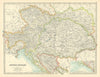


Robert Peary's claim to the North Pole, Napoleonic battlefields in European Russia and the Belgian Congo all appear in these vintage maps from The Handy Royal Atlas of Modern Geography, published in London by W. & A. K. Johnston Limited between 1911 and 1915. Alexander Keith Johnston created the atlas, and G. H. Johnston revised and corrected it. The plates range from Siam, Burma, Cambodia and Indochina to Kenya, Tanzania, Angola, Abyssinia and Upper Nubia, and from Manchuria, Korea, Japan and Sakhalin to Natal, the Orange Free State and Transvaal. New Zealand is shown with its counties and the Godley Glacier, and double-page plates include the world in twin hemispheres, a Pacific-centred Mercator projection, Hudson Bay, the Mississippi Valley and the western United States.
EU orders up to €150 are sent VAT- and duty-paid — no additional taxes on arrival
Authenticity Guaranteed - We only sell original antique & vintage items
Can we help? Call us on +44-208-960-3476 • FAQs
All our products are exempt from US tariffs — no additional duties or taxes payable on arrival.


- Shop by Country
- Shop by Cartographer
- Shop Maps by Type
- Shop Prints by Subject