


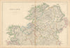

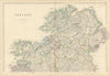

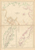


The Chinese Empire, the Caucasus, the Caribbean and the Pacific are mapped by a team of named mapmakers in The Imperial Atlas of Modern Geography, published by Blackie and Son under W. G. Blackie's supervision; the sheets here are dated 1859 and 1860. Joseph Wilson Lowry's North American maps record the divisions of the United States and British North America, while Edward Weller's reach Ireland, Indochina and the islands of Southeast Asia. Circumpolar maps, a Mercator world map and further island groups are also here, and names such as Burmah, Siam and Anam show the world as mid-nineteenth-century British readers knew it.
EU orders up to €150 are sent VAT- and duty-paid — no additional taxes on arrival
Authenticity Guaranteed - We only sell original antique & vintage items
Can we help? Call us on +44-208-960-3476 • FAQs
All our products are exempt from US tariffs — no additional duties or taxes payable on arrival.


- Shop by Country
- Shop by Cartographer
- Shop Maps by Type
- Shop Prints by Subject