


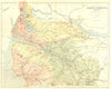


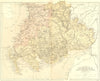


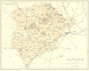

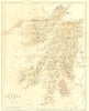
English and Scottish counties, and a telegraph map of the North Atlantic, make up these maps from The National Gazetteer, Virtue's illustrated topographical dictionary of the British Islands, published in London in 1868. The engraved maps, with William Hughes named as engraver on documented examples, include Durham, Dorset, Herefordshire, Huntingdonshire and Rutland, Scottish groupings for Argyll and Bute and the south-western counties, and a general map of England and Wales. The North Atlantic sheet, showing the telegraph cables, brings a distinctly Victorian subject of communication to the set.
EU orders up to €150 are sent VAT- and duty-paid — no additional taxes on arrival
Authenticity Guaranteed - We only sell original antique & vintage items
Can we help? Call us on +44-208-960-3476 • FAQs
All our products are exempt from US tariffs — no additional duties or taxes payable on arrival.


- Shop by Country
- Shop by Cartographer
- Shop Maps by Type
- Shop Prints by Subject