


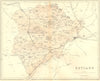

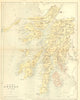

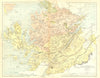

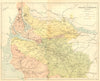


Mid-Victorian county maps, some coloured, accompany the entries in The National Gazetteer of Great Britain & Ireland, published in London by Virtue and Company and dated here to about 1860. Work credited to W. Hughes covers Herefordshire, Huntingdonshire, Buckinghamshire, Dorset, Kent and Somerset, small Rutland, Durham and Nottinghamshire. The Isle of Man and the Channel Islands have their own sheets, and the Scottish maps group Argyll with Bute or combine several central and western counties.
EU orders up to €150 are sent VAT- and duty-paid — no additional taxes on arrival
Authenticity Guaranteed - We only sell original antique & vintage items
Can we help? Call us on +44-208-960-3476 • FAQs
All our products are exempt from US tariffs — no additional duties or taxes payable on arrival.


- Shop by Country
- Shop by Cartographer
- Shop Maps by Type
- Shop Prints by Subject