


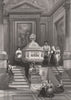


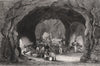


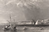


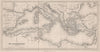

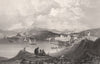

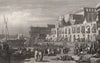


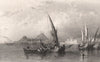


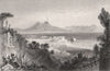







Palermo and Messina, Malta's harbours and the ruins of Carthage and Segesta appear in these prints from The Shores and Islands of the Mediterranean, the illustrated travel work associated with George Newenham Wright and published by Fisher, Son and Company around 1839–1840. The artists include William Leighton Leitch, Grenville Temple and H. E. Allen, and the plates move between Sicily, Gibraltar, Corfu, Malta and the Tunisian coast, setting cathedral interiors, convents and palaces beside streets, ports and ancient sites. The book's maps include Alexander Findlay's regional map of the Mediterranean and the Turkish Empire.
EU orders up to €150 are sent VAT- and duty-paid — no additional taxes on arrival
Authenticity Guaranteed - We only sell original antique & vintage items
Can we help? Call us on +44-208-960-3476 • FAQs
All our products are exempt from US tariffs — no additional duties or taxes payable on arrival.


- Shop by Country
- Shop by Cartographer
- Shop Maps by Type
- Shop Prints by Subject