


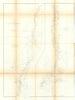


The United States Coast Survey, the federal body that charted American waters for navigation, combined coastal surveying with wider scientific work, and most of its maps here date from around 1860. Atlantic and Gulf charts cover New England, New York Bay, the Chesapeake, Florida and the Texas coast, and Pacific sheets run from San Diego and San Francisco to the Oregon and Washington shores and Puget Sound. Progress sketches show how the survey divided the coast into sections, and detailed sheets cover places such as Drakes Bay and the Mississippi Sound. A Gulf Stream chart, Labrador geology and diagrams from the 1860 solar eclipse expedition show its reach beyond navigation.
EU orders up to €150 are sent VAT- and duty-paid — no additional taxes on arrival
Authenticity Guaranteed - We only sell original antique & vintage items
Can we help? Call us on +44-208-960-3476 • FAQs
All our products are exempt from US tariffs — no additional duties or taxes payable on arrival.


- Shop by Country
- Shop by Cartographer
- Shop Maps by Type
- Shop Prints by Subject