


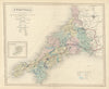


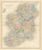


Railways cut across the old county divisions in maps from Walker's British Atlas, issues of 1868–1870 that continue the county series associated with J. & C. Walker and the Longman imprint. The railway network, joining industrial districts and coastal towns, is what sets these later issues apart from earlier stages of the series, and it is layered over roads, canals, towns and parliamentary boroughs. Individual English counties appear alongside a divided Yorkshire and Welsh counties grouped around shared routes, while national sheets cover Scotland, Ireland, with its counties and provinces, and England and Wales.
EU orders up to €150 are sent VAT- and duty-paid — no additional taxes on arrival
Authenticity Guaranteed - We only sell original antique & vintage items
Can we help? Call us on +44-208-960-3476 • FAQs
All our products are exempt from US tariffs — no additional duties or taxes payable on arrival.


- Shop by Country
- Shop by Cartographer
- Shop Maps by Type
- Shop Prints by Subject