


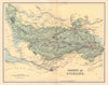


World atlas sheets and Scottish county maps both appear among these maps by Daniel Lizars (1793–1875), the Edinburgh publisher of the Lizars family workshop, who worked alongside his brother, the engraver William Home Lizars. The maps run from 1819 to 1895, some issued under the Lizars credit long after Daniel's death. European states and American, Asian and African regions sit beside detailed Scottish counties with parish divisions and railways, including maps associated with Francis H. Groome's Ordnance Gazetteer of Scotland, published by Thomas C. Jack. Daniel's role was that of publisher; he did not engrave every plate himself.
EU orders up to €150 are sent VAT- and duty-paid — no additional taxes on arrival
Authenticity Guaranteed - We only sell original antique & vintage items
Can we help? Call us on +44-208-960-3476 • FAQs
All our products are exempt from US tariffs — no additional duties or taxes payable on arrival.


- Shop by Country
- Shop by Cartographer
- Shop Maps by Type
- Shop Prints by Subject