


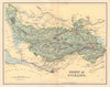

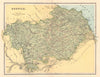


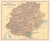


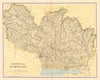


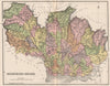


Forfarshire, Haddingtonshire and Linlithgowshire keep their old names in these maps from the Ordnance Gazetteer of Scotland, edited by Francis H. Groome and published in Edinburgh by Thomas C. Jack, with material dated 1885–1895. The county maps are credited to Lizars, while Bartholomew's regional sheets cover the Clyde estuary, the Moray Firth and the Firth of Tay. Town plans include Aberdeen and Greenock, and a map of the tweed-manufacturing districts of the Borders adds industry. Printed views show selected Scottish buildings and landscapes.
EU orders up to €150 are sent VAT- and duty-paid — no additional taxes on arrival
Authenticity Guaranteed - We only sell original antique & vintage items
Can we help? Call us on +44-208-960-3476 • FAQs
All our products are exempt from US tariffs — no additional duties or taxes payable on arrival.


- Shop by Country
- Shop by Cartographer
- Shop Maps by Type
- Shop Prints by Subject