
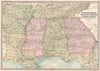


Maps of winds, rainfall, snow limits and religions sit beside the empires and colonies of 1890 in these maps from The Library Reference Atlas of the World, Bartholomew's late Victorian reference atlas published by Macmillan. Detailed regional sheets cover the British Isles, continental Europe, the Americas, Africa, Asia and Australasia. The United States is divided into regional groups, Canadian maps distinguish Ontario, Quebec and the Maritime Provinces, Australian maps show the colonial divisions with explorers' routes, and Indian sheets show the subcontinent under British administration. A composite of European city plans sets the capitals side by side, and the thematic maps include the ethnic classifications of the day.
EU orders up to €150 are sent VAT- and duty-paid — no additional taxes on arrival
Authenticity Guaranteed - We only sell original antique & vintage items
Can we help? Call us on +44-208-960-3476 • FAQs
All our products are exempt from US tariffs — no additional duties or taxes payable on arrival.


- Shop by Country
- Shop by Cartographer
- Shop Maps by Type
- Shop Prints by Subject