


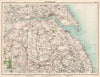


Colour relief, railway maps and town plans build a detailed picture of late Victorian England and Wales in The Royal Atlas, from the Peak District and the Yorkshire Dales to the South Hams. Edited by John George Bartholomew and published in London by George Newnes in 1898, the atlas combined mapping reduced from the Ordnance Survey with town plans and thematic charts. Its regional sheets follow the land across county boundaries, as along the Thames estuary, and its railway maps distinguish lines open from those under construction. Charts of population, rainfall and temperature add the statistics of the day, and detailed plans cover Liverpool, Birmingham, Plymouth and central London.
EU orders up to €150 are sent VAT- and duty-paid — no additional taxes on arrival
Authenticity Guaranteed - We only sell original antique & vintage items
Can we help? Call us on +44-208-960-3476 • FAQs
All our products are exempt from US tariffs — no additional duties or taxes payable on arrival.


- Shop by Country
- Shop by Cartographer
- Shop Maps by Type
- Shop Prints by Subject