


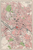


Coal and iron, textiles, crime and drunkenness are mapped alongside fields and towns in The Survey Gazetteer of the British Isles, edited by J. G. Bartholomew and published by George Newnes in 1904. Its maps go far beyond county geography, charting agricultural production, overseas trade, population density and occupations together with railways, canals, lighthouses and principal roads. Other sheets cover climate, geology, drainage and vegetation, administrative, parliamentary and ecclesiastical divisions, and the religious distribution of Ireland, while urban plans include London, Manchester and Leeds. The thematic sheets record the questions that occupied Edwardian statistical publishing.
EU orders up to €150 are sent VAT- and duty-paid — no additional taxes on arrival
Authenticity Guaranteed - We only sell original antique & vintage items
Can we help? Call us on +44-208-960-3476 • FAQs
All our products are exempt from US tariffs — no additional duties or taxes payable on arrival.


- Shop by Country
- Shop by Cartographer
- Shop Maps by Type
- Shop Prints by Subject