
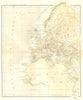


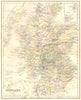


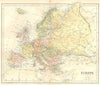


A Mercator world map with a supposed Antarctic coastline and maps of Sarmatia and Serica show the two sides of W. & R. Chambers's geographical publishing in 1864. The modern maps range from Scotland and Ireland to New Zealand and the American continents, and the world map marks the British Empire. Separate sheets of the ancient world cover Europe, North Africa and Asia under historical regional names such as Sarmatia, Gallia, Ariana and Serica.
EU orders up to €150 are sent VAT- and duty-paid — no additional taxes on arrival
Authenticity Guaranteed - We only sell original antique & vintage items
Can we help? Call us on +44-208-960-3476 • FAQs
All our products are exempt from US tariffs — no additional duties or taxes payable on arrival.


- Shop by Country
- Shop by Cartographer
- Shop Maps by Type
- Shop Prints by Subject